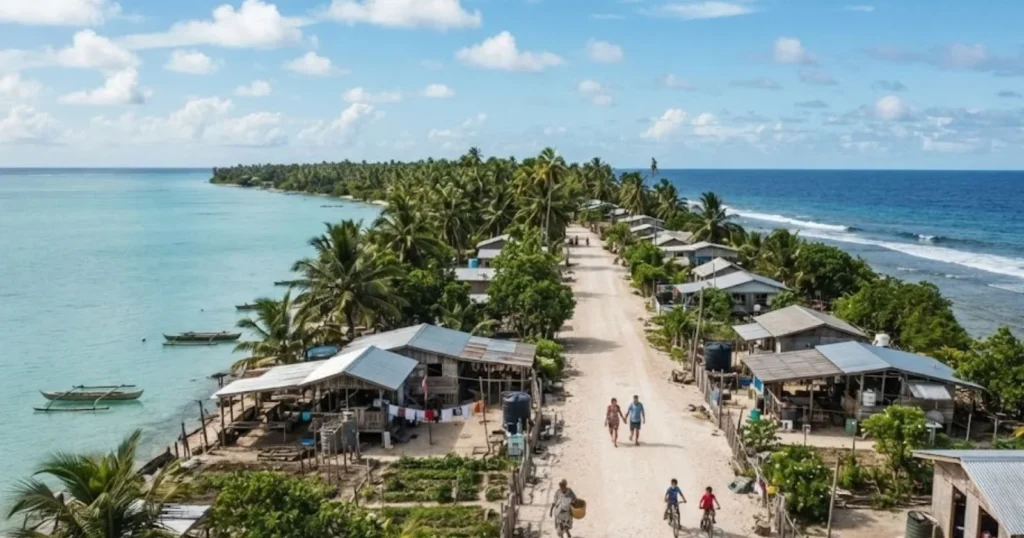
South Tarawa, the crowded capital of Kiribati, packs roughly 73,000 people onto just 15.76 square kilometers of low-lying atoll land, a population density that in some settlements reaches 5,200 people per square kilometer. A short flight away, Kiritimati, the world’s largest coral atoll and part of Kiribati’s Line Islands group, spreads its roughly 7,400 residents across 312 square kilometers, a density of just 16.6 people per square kilometer. Both places belong to the same country. The 20-fold gap between them is not a curiosity; it is the central fact of Kiribati’s demography.
Kiribati’s entire population, estimated at roughly 135,500 to 138,600 people as of 2026, occupies just 810 to 811 square kilometers of dry land, scattered across 32 atolls and one raised coral island, Banaba, spread over approximately 3.5 million square kilometers of ocean, an area comparable to India. That is one of the most extreme ratios of ocean territory to habitable land anywhere on Earth, and it explains almost everything else about where Kiribati’s people live, how crowded their capital has become, and how vulnerable the country is to a changing climate.
Key Facts & Findings
- Kiribati packs its entire population of roughly 135,500 to 138,600 people onto just 810 to 811 square kilometers of land spread across 3.5 million square kilometers of ocean, one of the most extreme land-to-ocean ratios of any nation.
- South Tarawa holds more than half of Kiribati’s national population on just 15.76 square kilometers, with localized density reaching 5,200 people per square kilometer.
- Kiritimati, the world’s largest coral atoll by land area (312 km²), has a population density of just 16.6 people per square kilometer, a twentyfold contrast with South Tarawa within the same country.
- Only about 23 of Kiribati’s roughly 33 islands are permanently inhabited; the Phoenix Islands are almost entirely uninhabited apart from Kanton’s 41 residents.
- Kiribati’s fertility rate of 3.15 children per woman (2023) has driven population growth of 1.48% to 1.8% a year, more than tripling the national population over the past 80 years.
- Life expectancy at 66.5 years (2023) remains lower than most Pacific neighbors, a gap researchers partly attribute to the health strains of extreme urban crowding in South Tarawa.
- National population density figures of roughly 171 per square kilometer conceal a settlement pattern where crowding varies more than twentyfold between the capital and outer islands.
Kiribati Population at a Glance
| Metric | Figure | Year / Source |
|---|---|---|
| Total population | 135,500–138,600 | 2026 estimate |
| Total land area | 810–811 km² | UN Statistics Division / SPC |
| Total ocean territory (Exclusive Economic Zone) | ~3.5 million km² | Pacific Community (SPC) |
| National population density | ~171 per km² | 2026 estimate |
| South Tarawa population | ~73,073 | 2026 |
| South Tarawa land area | 15.76 km² | Wikipedia / Kiribati NSO |
| South Tarawa population density | ~4,600–5,200 per km² (varies by settlement) | Recent estimates |
| Urban population share | 57.8–66.5% | 2020–2026, varying source and definition |
| Median age | 23 years | 2026 estimate |
| Total fertility rate | 3.15 children per woman | 2023, Our World in Data |
| Life expectancy | 66.5 years | 2023, Our World in Data |
| Annual population growth rate | 1.48–1.8% | Recent estimates |
Why Kiribati Has So Little Habitable Land
Kiribati is built almost entirely from coral atolls, ring-shaped reef formations enclosing a lagoon, with land that rarely rises more than three meters above sea level. Unlike volcanic islands such as Fiji or Samoa, which have interior highlands and substantial elevation, Kiribati’s atolls offer no natural high ground, no rivers, and extremely limited freshwater, most of which comes from a thin lens of groundwater sitting atop denser seawater beneath the sand, supplemented by rainfall.
This geology fundamentally limits how much of Kiribati’s 3.5 million square kilometers of ocean territory can actually support permanent settlement: of the country’s roughly 33 islands, only about 23 are inhabited, and even among those, several, such as Kanton in the Phoenix Islands with just 41 residents at the 2020 census, or Banaba with 333, support only small populations.
South Tarawa and Population Concentration
South Tarawa functions as Kiribati’s de facto primate city, holding more than half the national population, roughly 73,073 people as of 2026, up from 70,480 in 2020, within an area smaller than many single suburbs elsewhere in the world.
Population researchers monitoring Kiribati describe South Tarawa as effectively “full,” with continued in-migration from outer islands driving increasingly cramped housing and strained sanitation, given that most water, sewerage and municipal infrastructure is centrally provided by the national government and concentrated in the capital, one of the very reasons migration to South Tarawa continues despite already severe crowding.
Density varies sharply even within South Tarawa itself. Studies of coral reef and coastal health in Kiribati have measured population density as high as 5,200 people per square kilometer in South Tarawa, compared with just 300 people per square kilometer in South Tabiteuea, an outer island in the southern Gilbert group, illustrating how uneven Kiribati’s settlement pattern is even before comparing the Gilbert Islands to the more remote Line and Phoenix groups.
Population Distribution Across Kiribati
Kiribati’s population is organized around three island groups spanning the equator: the Gilbert Islands in the west, home to the vast majority of the population including South Tarawa; the Phoenix Islands in the center, almost entirely uninhabited apart from tiny Kanton; and the Line Islands in the east, which include Kiritimati, the world’s largest coral atoll by land area, along with a small number of other permanently inhabited islands.
The Gilbert Islands, per the CIA World Factbook, rank among the most densely settled places in the Pacific, while the Line and Phoenix groups remain sparsely populated despite spanning a much larger combined land area.
| Island Group | Notable Islands | Population Character |
|---|---|---|
| Gilbert Islands | South Tarawa, North Tarawa, Abaiang, Butaritari, Nonouti | Home to the large majority of the national population; South Tarawa alone exceeds half the country’s total |
| Phoenix Islands | Kanton | Almost uninhabited; Kanton had just 41 residents at the 2020 census |
| Line Islands | Kiritimati, Tabuaeran, Teraina | Sparsely populated relative to land area; Kiritimati (312 km²) has only ~7,369 residents |
Age Structure and Population Growth
Kiribati’s median age of 23 years and total fertility rate of 3.15 children per woman as of 2023 point to a population still firmly in an earlier stage of demographic transition, though UNFPA researchers note that Kiribati’s fertility decline effectively stalled for close to two decades before resuming.
Population growth of 1.48% to 1.8% annually, driven by 3,421 births against 933 deaths in 2023, according to Our World in Data, means Kiribati’s population has more than tripled over the past 80 years and continues to add residents steadily even as life expectancy, at 66.5 years, remains lower than most of its Pacific neighbors, partly a reflection of the health challenges that come with extreme urban crowding in South Tarawa.
Climate Change and Demographic Pressure
Kiribati’s combination of minimal elevation, limited freshwater, and extreme population concentration in South Tarawa makes it one of the most frequently cited examples of a nation facing existential climate risk.
Coastal erosion, storm surge inundation, sea spray damage to crops and freshwater contamination from saltwater intrusion have all been documented by climate researchers working in Kiribati, consistent with broader scientific assessments of low-lying atoll nations. It is important, however, to distinguish established physical observations, such as coastal erosion events already occurring, from longer-range projections about habitability, which remain subject to genuine scientific uncertainty about the pace and ultimate scale of sea level rise this century.
Migration and Climate Mobility
Kiribati’s government has pursued a deliberate, multi-track approach to population mobility rather than treating migration as a single climate response. This includes support for labor migration schemes to New Zealand and Australia, continued internal migration from outer islands to South Tarawa for services and employment, and longer-term adaptation planning that includes both in-country resilience measures and, more controversially, past government discussion of land purchases in Fiji intended partly as a hedge against future habitability concerns.
It is worth distinguishing these categories clearly: voluntary labor migration, internal rural-to-urban movement toward South Tarawa, and any future climate-linked displacement are different phenomena with different causes, even though all three affect where Kiribati’s population ultimately lives.
Can Kiribati Accommodate Future Population Growth?
With population growth continuing at 1.48% to 1.8% a year and South Tarawa already effectively at capacity, Kiribati faces a structural mismatch between where people want to live, driven by the concentration of government services, schools, healthcare and employment in the capital, and where additional population can realistically be accommodated.
Outer island development, aimed at reducing the pull toward South Tarawa by extending services and economic opportunity elsewhere in the Gilbert Islands and, to a lesser extent, the Line Islands, represents one of the few policy levers available to ease pressure on the capital, though implementation has been constrained by the same logistical challenges of distance and dispersion that define Kiribati’s geography in the first place.
Frequently Asked Questions
1. What is Kiribati’s population?
Kiribati’s population is estimated at roughly 135,500 to 138,600 people as of 2026, based on UN and Pacific Community data.
2. Where does most of Kiribati’s population live?
More than half of Kiribati’s population, an estimated 73,073 people as of 2026, lives in South Tarawa, the capital area in the Gilbert Islands.
3. Why is South Tarawa so crowded?
South Tarawa concentrates most of Kiribati’s government services, schools, healthcare and employment, drawing continued migration from outer islands even though the area, at just 15.76 square kilometers, is already considered effectively full by population researchers.
4. How much land does Kiribati have?
Kiribati’s total land area is only about 810 to 811 square kilometers, spread across 32 atolls plus the raised coral island of Banaba, within an ocean territory of roughly 3.5 million square kilometers.
5. How does climate change affect Kiribati’s population?
Kiribati’s low elevation, generally under three meters, and limited freshwater make it highly exposed to coastal erosion, storm surge and saltwater intrusion. Established physical impacts are already documented, though longer-term habitability projections carry genuine scientific uncertainty.
6. Are all of Kiribati’s islands inhabited?
No. Of Kiribati’s roughly 33 islands, only about 23 are permanently inhabited. The Phoenix Islands are almost entirely uninhabited, with Kanton Island home to just 41 people at the 2020 census.
7. What is Kiribati’s fertility rate?
Kiribati’s total fertility rate was 3.15 children per woman as of 2023, well above the global replacement level, though the country’s fertility transition stalled for nearly two decades before recently resuming its decline.
8. How urbanized is Kiribati?
Estimates of Kiribati’s urban population share range from roughly 57.8% to 66.5%, depending on the source and year, with South Tarawa and Kiritimati Island classified as the country’s urban areas.
9. What is Kiribati’s life expectancy?
Life expectancy at birth in Kiribati was 66.5 years as of 2023, lower than most Pacific Island neighbors, a gap linked partly to the health pressures of extreme crowding in South Tarawa.
10. Why is Kiritimati so different from South Tarawa?
Kiritimati is the world’s largest coral atoll by land area (312 km²) but has a population of only about 7,369, giving it a population density of just 16.6 people per square kilometer, compared with South Tarawa’s density of up to 5,200 people per square kilometer, despite both being part of the same country.
Sources
- Pacific Community (SPC), Statistics for Development Division, Kiribati country profile
- United Nations, Department of Economic and Social Affairs, Population Division, World Population Prospects: The 2024 Revision
- Our World in Data, “Population and Demography Country Profile: Kiribati” (2026)
- UNFPA Pacific, “Population and Development Profiles: Pacific Island Countries”
- Save Kiribati, Population overview
- National Center for Biotechnology Information (NCBI/PMC), “Interactive Dynamics of Coral Reef Fisheries and the Nutrition Transition in Kiribati” (density comparisons between South Tarawa and South Tabiteuea)
- CIA World Factbook Archive (2025), Kiribati country entry
- Wikipedia, South Tarawa, Tarawa, Kiritimati and North Tarawa (island-level population data cross-referenced against Kiribati National Statistics Office and census sources)