
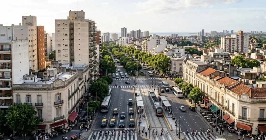
Argentina’s population stood at roughly 46 million people in 2026, and nearly half of them, about 20.75 million, live in a single province-city pairing: Buenos Aires Province together with the Autonomous City of Buenos Aires (CABA). Add in Córdoba and Santa Fe, and three provinces plus the capital account for roughly 60 percent of the entire country’s population, on a fraction of its 2.78 million square kilometers of territory. Meanwhile, vast stretches of Patagonia in the south hold only a few people per square kilometer. Argentina is not evenly settled. It is a country built around one metropolitan area, with everywhere else arranged at varying distances from it.
Key Fact & Findings
- Buenos Aires Province and the Autonomous City of Buenos Aires together hold about 20.75 million people, roughly 45 percent of Argentina’s national population of 46 million.
- Greater Buenos Aires, on the broadest INDEC metropolitan definition, holds approximately 16.5 million residents, making it one of the largest metropolitan areas in South America.
- Buenos Aires, Córdoba and Santa Fe provinces together account for roughly 60 percent of the national population.
- Tierra del Fuego, Antártida e Islas del Atlántico Sur is Argentina’s least populous province, with 185,732 residents at the 2022 census, despite covering a large southern territory.
- Patagonian provinces show the country’s highest shares of residents born elsewhere, led by Tierra del Fuego at 54.5 percent, reflecting energy-sector and incentive-driven in-migration.
- Nearly 6.9 million native-born Argentines, 15.8 percent of that population, live outside the province where they were born.
Where Argentina’s Population Lives Today
Argentina’s 2022 census counted roughly 46 million residents nationally, and the provincial breakdown makes the concentration explicit.
Population by Leading Province, 2022 and 2026
| Province/District | Population (2022) | Population (2026) |
|---|---|---|
| Buenos Aires Province | 17,569,053 | 17,794,009 |
| Córdoba | 3,978,984 | 3,927,355 |
| Santa Fe | 3,556,522 | 3,581,357 |
| City of Buenos Aires (CABA) | 3,120,612 | 3,368,589 |
| Mendoza | 2,014,533 | 1,994,188 |
| Tucumán | 1,703,186 | 1,717,609 |
| Salta | 1,440,672 | 1,457,878 |
| Entre Ríos | 1,426,426 | 1,453,314 |
Buenos Aires Province and CABA together hold about 20.75 million people, or roughly 45 percent of the national population. Córdoba and Santa Fe, the second and third largest provinces, add another 7.5 million between them. Together, these four jurisdictions, Buenos Aires Province, CABA, Córdoba and Santa Fe, hold close to 60 percent of Argentina’s population on well under a fifth of its land area.
Why Buenos Aires Became Argentina’s Population Center
The concentration is not a modern accident. It traces to Buenos Aires’ role as Argentina’s primary Atlantic port from the colonial era onward, which gave the city an early and lasting advantage in trade, capital accumulation and political control. Nineteenth-century Argentina built its economy on beef and grain exports funneled through the port of Buenos Aires, and the wealth that generated concentrated financial institutions, transport infrastructure and government functions in the same place. Political centralization reinforced the pattern: Buenos Aires has been the national capital since the country’s formation, giving it a permanent gravitational pull for administrative jobs, embassies and federal institutions that no interior city could match.
Industrialization in the twentieth century deepened rather than dispersed the concentration. Manufacturing investment clustered around the greater Buenos Aires because that is where transport links, ports and the largest consumer market already existed, a self-reinforcing cycle common to primate cities worldwide. Waves of European immigration, chiefly Italian and Spanish, arrived through the Port of Buenos Aires between the 1880s and 1930s and disproportionately stayed near their point of entry rather than dispersing into the interior, adding millions of residents directly to the metropolitan area over a few decades.
Greater Buenos Aires and Metropolitan Concentration
Greater Buenos Aires, as defined by INDEC, combines the Autonomous City with the surrounding partidos of Buenos Aires Province. The core 24-partido conurbation held 10.87 million people at the 2022 census; including the Federal District brings that to just under 14 million, and the broader metropolitan definition that adds outlying partidos and Greater La Plata reaches roughly 16.5 million people, making it one of the largest urban agglomerations in South America and among the largest in the Western Hemisphere.
That scale brings the familiar pressures of metropolitan primacy. Commuting distances from outer partidos into the city center regularly exceed an hour each way on overcrowded rail and bus networks. Housing costs in CABA and the inner suburbs have risen well ahead of incomes for much of the population, pushing lower-income growth toward informal settlements on the metropolitan periphery, a pattern documented for decades in Buenos Aires’ conurbano bonaerense. Infrastructure planning, from water and sanitation to transit expansion, has struggled to keep pace with a metropolitan population that continues to add residents through both natural growth and continued internal migration from other provinces.
The Population Outside Buenos Aires
Argentina’s second tier of population centers is smaller but still substantial. Córdoba province, anchored by the city of Córdoba at roughly 1.4 million people, is Argentina’s second-largest urban center and functions as an independent regional economy built around manufacturing and agriculture rather than as a Buenos Aires satellite. Santa Fe province, centered on Rosario, a major grain-export port city of roughly 1.3 million, plays a similar role for the Pampas’ agricultural export economy. Mendoza, in the west, anchors a wine-producing region with just under 2 million residents, while Tucumán and Salta represent the more populous ends of Argentina’s northwestern provinces.
None of these approach Buenos Aires in scale, but together they represent Argentina’s genuine second-tier urban network, cities large enough to generate their own labor markets, universities and cultural institutions rather than functioning purely as feeders into the capital.
Argentina’s Uneven Population Density
The gap between the Pampas-and-metropolitan corridor and the rest of the country is stark. Buenos Aires Province, Córdoba and Santa Fe, Argentina’s demographic and agricultural core, sit within the fertile Pampas region and combine high population with high agricultural productivity. By contrast, the Patagonian provinces in the south, Santa Cruz, Chubut, Río Negro, Neuquén and Tierra del Fuego, cover a huge share of national territory while holding a small fraction of the population, a function of colder climate, more limited arable land and historically later, more sparsely populated settlement.
Interprovincial migration data illustrate the pull these two zones exert in opposite ways. At the 2022 census, 15.8 percent of Argentina’s native-born population, nearly 6.9 million people, were living in a province other than the one where they were born. The provinces with the highest shares of residents born elsewhere were concentrated in Patagonia and the resource-driven interior:
Tierra del Fuego at 54.5 percent, Santa Cruz at 41.8 percent, and Neuquén at 28.1 percent, reflecting in-migration tied to energy-sector employment, public administration jobs and, in Tierra del Fuego’s case, tax-incentivized manufacturing. Misiones, San Juan, Formosa and Chaco showed the lowest mobility, each under 10 percent, indicating populations that have stayed close to their province of birth.
Internal Migration and International Immigration
Argentina’s population geography reflects two distinct migration histories layered on top of each other. The first is the late nineteenth and early twentieth century wave of European immigration, overwhelmingly Italian and Spanish, that arrived through Buenos Aires and remains visible in the country’s demographic and cultural profile today. That immigration was heavily urban and heavily concentrated in and around the capital, reinforcing rather than counterbalancing the country’s existing primacy.
The second is ongoing internal migration, which today moves in more varied directions than the historic rural-to-Buenos Aires pattern. Some of the strongest recent growth has occurred in interior Buenos Aires Province itself and in energy-producing Patagonian provinces, where hydrocarbon and, more recently, shale development around Vaca Muerta in Neuquén has drawn workers from other provinces. This marks a partial shift away from the twentieth century’s dominant pattern of migration flowing exclusively toward the capital.
Urbanization and the Future Population Map
Argentina is already one of Latin America’s most urbanized countries, and continued metropolitan concentration remains the most likely trajectory absent a major shift in economic geography. Secondary cities such as Córdoba, Rosario and Mendoza are likely to keep absorbing a growing share of internal migration that once would have gone straight to Buenos Aires, a pattern consistent with slowing growth in the core 24-partido conurbation relative to its outer ring and to interior provincial cities. At the same time, national demographic aging, consistent with broader regional trends across the Southern Cone, will shape population change in the older, already-settled core differently than in younger, migration-driven Patagonian provinces.
What Buenos Aires Concentration Means for Argentina
A population geography this concentrated carries structural consequences that extend well beyond commuting statistics. Housing markets in and around CABA face persistent affordability pressure because supply cannot expand as freely as demand from continued in-migration and natural growth. Labor markets are similarly lopsided: the greater Buenos Aires area hosts a disproportionate share of formal-sector employment, professional services and higher education institutions, which in turn reinforces the incentive for ambitious young Argentines from the interior to relocate rather than build careers regionally.
Public service delivery, from transit to healthcare capacity, has to serve a metropolitan population an order of magnitude larger than any other Argentine urban area, a scale mismatch that recurs in national infrastructure and budget planning whenever it tries to treat “Argentina” as a single, evenly distributed unit rather than a country organized around one dominant metropolitan core and a much thinner periphery.
Conclusion
Argentina’s population map still bears the imprint of decisions made more than a century ago: where a port sat, where a capital was fixed, and which city European immigrants stepped off their ships into. Nearly half the country’s population now lives within Buenos Aires Province and its capital city, a concentration that has proven remarkably durable even as internal migration has begun diversifying toward Córdoba, Santa Fe and energy-driven Patagonian provinces. Understanding Argentina’s population geography means understanding that Buenos Aires is not simply the largest city; it is the gravitational center the rest of the country’s demographic map is organized around.
Frequently Asked Questions
1. Why does so much of Argentina’s population live around Buenos Aires?
Buenos Aires’ role as Argentina’s primary Atlantic port and its status as national capital since the country’s formation concentrated trade wealth, industry, and government employment there for more than a century, a pattern reinforced by early twentieth-century European immigration that arrived through the same port city.
2. What percentage of Argentina lives in Buenos Aires?
Buenos Aires Province together with the Autonomous City of Buenos Aires holds about 20.75 million people, roughly 45 percent of Argentina’s national population of 46 million, as of 2026 estimates built on the 2022 census.
3. Which Argentine provinces have the largest populations?
Buenos Aires Province (17.8 million, 2026), Córdoba (3.9 million), Santa Fe (3.6 million)’ and the City of Buenos Aires (3.4 million) are the four largest jurisdictions, together holding close to 60 percent of the national population.
4. What is the difference between Buenos Aires City, Buenos Aires Province and Greater Buenos Aires?
The City of Buenos Aires (CABA) is an autonomous federal district of about 3.4 million people. Buenos Aires Province is a separate, much larger jurisdiction of 17.8 million surrounding the city. Greater Buenos Aires is a metropolitan statistical concept combining CABA with adjoining partidos of Buenos Aires Province, variously defined at 10.9 million, 14 million, or 16.5 million depending on how many outer partidos are included.
5. Which is Argentina’s least populous province?
Tierra del Fuego, Antártida e Islas del Atlántico Sur, with 185,732 residents at the 2022 census, though it has one of the country’s highest shares of in-migrants relative to its size.
6. Is Argentina’s population still concentrated in Buenos Aires, or is that changing?
The core concentration remains dominant, but growth has diversified somewhat, with interior Buenos Aires Province, Córdoba, Santa Fe, and energy-producing Patagonian provinces such as Neuquén absorbing a growing share of internal migration relative to the historic pattern of moving directly into the capital.
7. What drove European immigration to Buenos Aires?
Argentina actively recruited European immigrants, chiefly from Italy and Spain, from the 1880s through the 1930s to work the expanding agricultural export economy and populate the growing city; most arrivals stayed in or near Buenos Aires rather than moving to the interior.
8. How dense is Buenos Aires compared with the rest of Argentina?
Greater Buenos Aires’ metropolitan density is over 3,900 people per square kilometer, while much of Patagonia in the south holds only a handful of people per square kilometer, among the starkest density contrasts of any country in the Americas.
9. Why is Neuquén province growing quickly?
Shale oil and gas development at the Vaca Muerta formation has drawn substantial in-migration of workers from other provinces, making Neuquén one of the provinces with the highest share of residents born elsewhere.
10. Are secondary cities like Córdoba and Rosario growing faster than Buenos Aires?
Córdoba and Santa Fe provinces, anchored by Córdoba city and Rosario respectively, have maintained steady growth and increasingly absorb migration that in past decades would more often have gone directly to greater Buenos Aires, though the capital region remains by far the largest destination in absolute terms.
Sources
- Instituto Nacional de Estadística y Censos (INDEC), 2022 National Census of Population, Households and Housing
- INDEC, Population and Projections by Province, 2022-2026
- List of Argentine provinces by population, compiled from INDEC census and estimate data
- Greater Buenos Aires metropolitan statistics, INDEC 2022 Census