Brazil’s population reached 214.2 million people as of July 1, 2026, according to IBGE estimates, but that figure hides a country split into five demographic worlds. The Southeast alone holds 89 million people, more than the next two regions combined, while the Central-West, an area larger than Mexico, holds barely 17.4 million.
Population density ranges from roughly 91 people per square kilometer in the Southeast to under 5 in the North. Median age has climbed six years nationally since 2010, but the North remains a region of children while the South and Southeast are aging toward European proportions. These are not small statistical variations. They are the fingerprints of a settlement history built on ports, plantations, gold rushes, industrial policy and, more recently, agribusiness expansion into the interior.
Brazil’s Population Is Distributed Unevenly Across Its Regions
Brazil is organized into five official macro-regions defined by IBGE: North, Northeast, Southeast, South and Central-West. Each groups several states with broadly similar geography, but the boundaries also carry decades of accumulated statistical and policy meaning, since federal transfers, infrastructure planning and regional development funds are all built around them.
Population at a Glance (July 2026, IBGE Estimate)
| Region | Population | Share of Brazil | Density (per km², 2022 census) |
|---|---|---|---|
| Southeast | 89.0 million | 41.6% | 91.4 |
| Northeast | 57.4 million | 26.8% | 35.0 |
| South | 31.5 million | 14.7% | 51.8 |
| North | 18.9 million | 8.8% | 4.7 |
| Central-West | 17.4 million | 8.1% | 10.1 |
Two patterns stand out immediately. First, population size and population density do not move together. The North is Brazil’s largest region by land area, roughly 45 percent of the national territory, yet its density is the lowest by a wide margin because most of it is Amazon rainforest with limited road access. Second, the Southeast combines both a large population and high density, which is what makes it the country’s demographic and economic center of gravity at the same time.
State-level variation inside each region is often larger than the regional averages suggest. São Paulo state alone had 44.4 million residents at the 2022 census, about 21.6 percent of Brazil’s population and larger than every other South American country except Brazil itself. Roraima, in the North, had just 636,707 residents in 2022, making it the least populous state in the country. A regional label like “Southeast” or “North” therefore describes an average across states that can differ from each other by a factor of fifty or more.
The Southeast Remains the Demographic Center of Brazil
São Paulo, Minas Gerais, Rio de Janeiro and Espírito Santo together form the Southeast, and their combined weight has defined Brazil’s population map since industrialization accelerated in the mid-twentieth century. The region’s share of the national population has stayed close to 42 percent for over two decades, moving only marginally as growth in other regions has slightly outpaced it.
The concentration traces back to a specific historical sequence. Coffee wealth in the nineteenth century built São Paulo’s early infrastructure and financial base. Industrial policy from the 1930s onward, especially the automotive and manufacturing push centered on greater São Paulo, then pulled in millions of migrants from the Northeast and from the South’s rural interior in search of factory wages. Rio de Janeiro’s long stint as national capital until 1960 reinforced the region’s administrative and financial weight even after Brasília took over federal government functions.
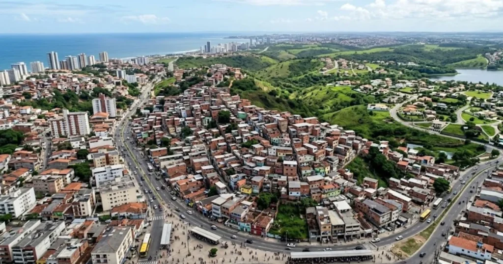
That legacy shows up today in metropolitan scale. Greater São Paulo remains the largest metropolitan area in the Southern Hemisphere, and the Rio de Janeiro metropolitan area is not far behind. Both regions face the flip side of that success: housing costs and commute times in São Paulo’s periphery are among the most severe in Latin America, and informal settlement growth on the urban fringe has become a defining feature of the metropolitan area’s expansion, since formal housing supply has not kept pace with the population that migration and natural growth continue to add.
The Northeast Has a Different Demographic Story
The Northeast holds 57.4 million people, the second-largest regional population in Brazil, but its demographic trajectory diverges sharply from the Southeast’s. Historically, the region combined the country’s highest fertility rates with recurring drought cycles in the semi-arid interior, a combination that for most of the twentieth century pushed millions of Northeasterners toward the Southeast in search of work, a migration corridor so large it became a defining feature of Brazilian internal demography.
That pattern has weakened, though it has not disappeared. Population growth in the Northeast between the 2010 and 2022 censuses was just 2.97 percent, the slowest of any region and far below the Southeast’s 5.57 percent over the same period, which on its own would suggest continued net outflow. But fertility decline has been the larger driver of the Northeast’s changing demographic weight: the region’s total fertility rate fell from 7.39 children per woman in 1960 to 1.56 in 2023, converging toward the low national average rather than staying elevated the way it once did.
Urbanization has also accelerated, with cities such as Fortaleza, Recife and Salvador absorbing rural migrants who once would have continued on to São Paulo. The historic Northeast-to-Southeast corridor still exists, but it is thinner than it was, and a meaningful share of internal movement inside the Northeast now flows rurally to nearby metro areas rather than across the country.
The North and Amazon Region Present a Population Density Contrast
The North region covers about 45 percent of Brazil’s land area but holds only 8.8 percent of its population, a mismatch that makes it the most sparsely settled region in the country by a wide margin, at roughly 4.7 people per square kilometer against a national average near 25. Most of the North sits within the Amazon basin, where dense forest, limited road infrastructure and river-dependent transport have historically constrained the scale of settlement outside a handful of urban centers.
Manaus is the clearest example of the region’s urban concentration pattern: a city of several million people functioning as an economic and logistical hub inside a state, Amazonas, where the vast majority of territory remains sparsely inhabited. The same pattern, cities acting as isolated population islands surrounded by low-density forest and river territory, repeats across Pará, Amazonas, Acre and Rondônia, with implications for everything from healthcare access to school placement, since reaching dispersed river communities can require boat travel of a day or more.
Demographically, the North is also Brazil’s youngest region. It had the country’s highest fertility rate in 2023, at 1.83 children per woman, and the youngest median age, rising from just 24 in 2010 to 29 in 2022, a full six years below the Southeast’s median of 37. A quarter of the North’s population, 25.2 percent, was under 14 years old at the 2022 census, the highest share of any region.
Southern Brazil Has Distinct Demographic Characteristics
Paraná, Santa Catarina and Rio Grande do Sul make up the South, home to 31.5 million people, or 14.7 percent of the national population, at a density of roughly 52 people per square kilometer, second only to the Southeast. The region’s settlement history differs from the rest of Brazil in one important respect: nineteenth and early twentieth century European immigration, chiefly German, Italian and Polish, shaped its rural and small-town population base in a way distinct from the Portuguese colonial and enslaved-African demographic foundations that dominate elsewhere in the country.
That history left the South with a more dispersed pattern of mid-sized cities rather than one dominant metropolis, along with household and family structures that demographers have long noted differ somewhat from national averages. What stands out most in current data, however, is aging. The South’s median age rose from 31 to 36 between 2010 and 2022, and 12.1 percent of its population was 65 or older at the last census, nearly matching the Southeast’s 12.2 percent and placing it among Brazil’s oldest regions. Rio Grande do Sul recorded one of the lowest population growth rates of any state in the most recent IBGE estimates, consistent with a region where fertility has fallen furthest and outmigration of younger residents to other states continues.
The Central-West Is One of Brazil’s Major Population Growth Areas
The Central-West, comprising Goiás, Mato Grosso, Mato Grosso do Sul and the Federal District, is Brazil’s smallest region by population, at 17.4 million, but it has been the fastest-growing over the past intercensal period, expanding 15.87 percent between 2010 and 2022, more than double the Southeast’s growth rate and nearly quintuple the Northeast’s.
Two forces explain the surge. Brasília’s founding in 1960 as the new federal capital created a population center from essentially nothing, and the Federal District has continued to draw civil servants, contractors and service workers ever since; greater Brasília is now among the largest metropolitan areas in the country. Separately, the Central-West has become the epicenter of Brazil’s soy, corn and cattle export boom, converting large stretches of cerrado grassland into some of the most productive agricultural land in the world and pulling in migrant labor and agribusiness investment from across the country. Mato Grosso and Mato Grosso do Sul in particular have absorbed population growth tied directly to this agricultural frontier expansion, with several municipalities recording IBGE’s highest annual growth rates nationally in 2025 and 2026 estimates.
How Migration Created Brazil’s Regional Demographic Divide
None of the regional contrasts above are accidents of geography alone. They are the accumulated result of internal migration flows that have moved millions of Brazilians across the country over the past century, each wave driven by a different economic push or pull.
The largest and longest-running of these flows sent Northeasterners toward São Paulo and Rio de Janeiro from the 1930s through the 1980s, driven by drought, land scarcity and the pull of industrial-era factory jobs. A second flow moved southern farmers and their descendants toward the agricultural frontier in the Central-West and parts of the North from the 1970s onward, following the expansion of soy cultivation and government-backed settlement programs.
A third and more recent pattern has been intra-regional: rural-to-urban movement within the Northeast and North, as residents relocate to regional capitals such as Fortaleza, Belém and Manaus rather than making the longer journey to the Southeast. Each of these flows left a measurable signature in the age structure, fertility rate and growth rate tables above.
Fertility and Age Structure Are Changing the Regional Balance
Brazil’s national fertility rate fell from 2.32 children per woman in 2000 to 1.57 in 2023, and IBGE projects a further decline to 1.44 by 2040, its expected low point. That national trend, however, conceals a regional gap that is itself narrowing.
Fertility Rate by Region, 2023
| Region | Total Fertility Rate | 1960 Fertility Rate |
|---|---|---|
| North | 1.83 | 8.56 |
| Central-West | 1.71 | n/a |
| Northeast | 1.56 | 7.39 |
| South | 1.56 | n/a |
| Southeast | 1.48 | n/a |
| Brazil | 1.57 | 6.28 |
The North and Central-West still post the country’s highest fertility rates, but even these are now below the replacement level of roughly 2.1, meaning every region in Brazil is now demographically aging, just at different speeds. The Southeast and South, where fertility fell earliest, show it in their median age and elderly share: 37 and 36 respectively, versus 29 in the North. IBGE’s national ageing index, which measures elderly people per 100 children, jumped from 30.7 in 2010 to 55.2 in 2022, and that ratio is highest in the Southeast and South and lowest in the North, meaning the regional demographic divide is now as much about age structure as it is about raw population size.
Urbanization Is Reshaping Brazil’s Population Geography
Brazil is already a highly urbanized country, and urbanization has been one of the main mechanisms translating regional migration into the population map described above. Metropolitan concentration is most extreme in the Southeast, where São Paulo and Rio de Janeiro’s metro areas alone account for tens of millions of residents, but the pattern repeats at smaller scale in every region: Recife and Salvador in the Northeast, Porto Alegre in the South, Manaus in the North, and Brasília and Goiânia in the Central-West.
IBGE’s 2025 and 2026 municipal estimates point to a related but distinct trend: population decline is increasingly a small-town and rural phenomenon rather than a regional one. In the July 2026 estimate, 37.3 percent of Brazil’s 5,571 municipalities showed a population decrease, concentrated heavily among towns under 20,000 residents, while medium-sized cities of 100,000 to 500,000 people posted the strongest growth of any municipal size category. That means the story of Brazilian population geography today is less “region gains, region loses” and more “small towns empty out, mid-sized cities absorb the difference,” a pattern playing out inside every one of the five macro-regions simultaneously.
What Brazil’s Regional Demographic Divide Means for the Future
IBGE’s population projections, built from the 2022 census, show Brazil’s national population peaking at 220.4 million in 2041 before beginning a slow decline toward 199.2 million by 2070. That national trajectory will not arrive evenly. Regions that are aging fastest, the Southeast and South, are likely to see their populations plateau and shrink first, while the North and parts of the Northeast, still several years from replacement-level fertility, will keep contributing a disproportionate share of Brazil’s remaining growth for longer.
The practical consequences touch labor supply, infrastructure and public finance simultaneously. An aging Southeast and South face rising demand for pensions and elder care just as their working-age population growth slows. A still-young North and Northeast face continued pressure to expand schools and entry-level job creation even as national fertility keeps falling.
Regional inequality in per capita infrastructure spending, already a long-standing feature of Brazilian federalism, is likely to interact with these diverging demographic clocks in ways that federal transfer formulas, largely built around population counts rather than age structure, do not yet fully account for.
Conclusion
Brazil’s population map is less a single national story than five overlapping ones, each moving at its own demographic speed. The Southeast’s industrial-era gravity still holds the largest share of the country, but the fastest change right now is happening at the edges: fertility collapsing across every region simultaneously, the Central-West’s agribusiness frontier adding people faster than anywhere else, and small towns everywhere losing residents to mid-sized cities. What began as one Brazil’s story, Northeast to Southeast migration, has become five distinct regional trajectories, and the 2041 national population peak IBGE now projects will arrive in the Southeast and South years before it reaches the North.
Key Findings
- The Southeast holds 41.6 percent of Brazil’s population on just under 11 percent of its land area, making it both the country’s most populous and one of its most densely settled regions.
- The Central-West was Brazil’s fastest-growing region between the 2010 and 2022 censuses, expanding 15.87 percent, driven by Brasília’s civil-service economy and the cerrado agricultural boom.
- The North remains Brazil’s youngest region, with the highest fertility rate (1.83 in 2023) and lowest median age (29 in 2022), a full eight years below the Southeast.
- National fertility fell from 6.28 children per woman in 1960 to 1.57 in 2023 and is projected to bottom out near 1.44 around 2040.
- Brazil’s ageing index more than doubled between 2010 and 2022, from 30.7 to 55.2 elderly people per 100 children, with the sharpest aging concentrated in the Southeast and South.
- IBGE projects national population growth will stop in 2041 at 220.4 million before declining to about 199.2 million by 2070.
- Population decline is increasingly concentrated in small municipalities under 20,000 residents rather than in entire regions, with mid-sized cities absorbing much of the country’s remaining growth.
Frequently Asked Questions
1. Which region of Brazil has the largest population?
The Southeast, with 89 million people as of the July 2026 IBGE estimate, or 41.6 percent of Brazil’s total population of 214.2 million.
2. Why is Brazil’s population concentrated in the Southeast?
A combination of nineteenth-century coffee wealth, twentieth-century industrialization centered on São Paulo, and decades of internal migration from the Northeast pulled population and investment into the region, a concentration that has persisted even as growth rates elsewhere have caught up.
3. Which Brazilian regions are aging fastest?
The Southeast and South show the oldest age structures, with median ages of 37 and 36 respectively in 2022, compared with 29 in the North, and both have the highest shares of residents aged 65 and over, at 12.2 and 12.1 percent.
4. Is Brazil’s population still growing?
Yes, but slowly. The national growth rate fell to 0.37 percent in the 2025 to 2026 period, and IBGE projects growth will stop entirely in 2041 at a peak of 220.4 million people.
5. What is Brazil’s least populous state?
Roraima, in the North region, with 636,707 residents at the 2022 census.
6. What is Brazil’s most populous state?
São Paulo, with 44.4 million residents at the 2022 census, about 21.6 percent of the national population.
7. Why did the Central-West grow so fast between 2010 and 2022?
Expansion of soy, corn and cattle agribusiness across the cerrado, combined with continued growth in Brasília’s federal-capital economy, drove population growth of 15.87 percent, the highest of any region in that period.
8. Is the historic Northeast-to-Southeast migration pattern still happening?
It continues but at a reduced scale. Falling fertility in the Northeast and growing regional cities such as Fortaleza and Recife have absorbed more of the population that previously would have moved to São Paulo or Rio de Janeiro.
9. Why is population density so low in the North region?
The North covers about 45 percent of Brazil’s territory, most of it Amazon rainforest with limited road access, and holds only 8.8 percent of the national population, producing a density of roughly 4.7 people per square kilometer.
10. Will Brazil’s population eventually decline?
IBGE’s official projections show national population declining from a 2041 peak of 220.4 million to about 199.2 million by 2070, though projections this far out carry meaningful uncertainty and depend on fertility, mortality and migration assumptions holding roughly steady.
Sources
- Instituto Brasileiro de Geografia e Estatística (IBGE), Population Estimates 2025 and 2026, Agência de Notícias
- IBGE, 2022 Population Census, Panorama do Censo 2022
- IBGE, 2022 Census: Fertility and Migration Preliminary Sample Results
- IBGE, Population Projections 2024 (based on 2022 Census)
- IBGE, 2010 Population Census
- CIA World Factbook, Demographics of Brazil