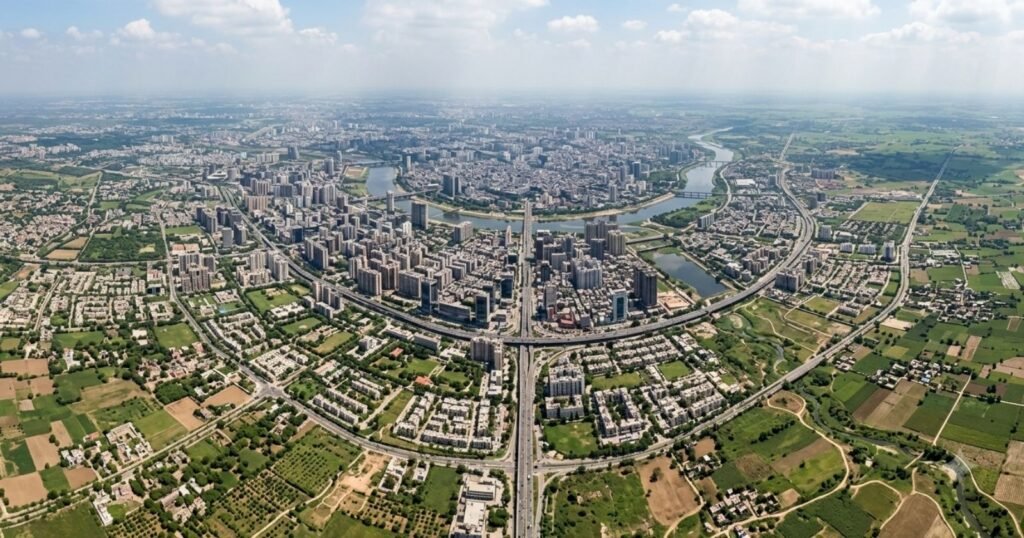
Half of the world’s population lives on less than 4 percent of the planet’s available land area, according to gridded population research from Columbia University’s Center for International Earth Science Information Network. Extend the comparison further and the pattern gets starker still: roughly 95 percent of humanity lives on just 10 percent of Earth’s land, according to World Bank and Joint Research Centre analysis, meaning the other 90 percent of the planet’s land surface, deserts, mountains, polar regions, and dense forest, supports only about 5 percent of the human population.
These are not new phenomena driven by modern urbanization alone; geographers have described the pattern for over a century. What has changed is the scale and precision of the data available to quantify exactly how uneven human distribution really is, down to the level of individual grid cells covering just a few square kilometers each.
How Unevenly Is Humanity Distributed
If population were spread evenly across all inhabitable land, a plot of cumulative population against cumulative land area would form a straight diagonal line: 10 percent of land holding 10 percent of population, and so on. In reality, that curve bends sharply, which is precisely what the “50 percent of population on 4 percent of land” and “95 percent of population on 10 percent of land” figures describe. The more land area you consider, the smaller the marginal population gain, because so much of Earth’s surface is barely habitable at all.
What Share of Land Contains What Share of Population
| Share of World Population | Share of Land Area Required |
|---|---|
| 50% | Less than 4% |
| 95% | Approximately 10% |
| Remaining 5% | Remaining approx. 90% |
Source: Columbia University Center for International Earth Science Information Network (CIESIN) gridded population analysis; European Commission Joint Research Centre and World Bank agglomeration index research. A separate, frequently cited estimate from the Global Human Settlement Layer finds that about 40 percent of Earth’s land surface has a population density below 1 person per square kilometer, encompassing deserts, high mountains, rainforest interiors, and polar regions.
The World’s Biggest Population Concentrations
South Asia
India and Bangladesh together support well over 1.5 billion people on a combined land area smaller than the United States, producing some of the highest sustained rural population densities anywhere on Earth, particularly across the Gangetic plain.
East Asia
China’s eastern seaboard and river valleys concentrate the overwhelming majority of the country’s population on a comparatively small share of its total land area, with vast interior regions, including much of Tibet and Xinjiang, remaining sparsely populated.
Southeast Asia
Java, the most populous island in Indonesia, holds well over half the country’s population on roughly 7 percent of its total land area, one of the starkest examples of population concentration at a national scale anywhere in the world.
Europe
Population concentrates along a corridor sometimes called the “Blue Banana,” stretching from England through the Low Countries, western Germany, and into northern Italy, a legacy of industrial era development that continues to shape settlement patterns today.
An early twentieth century geographic observation held that the population agglomeration across Monsoon Asia, spanning Japan, China, Java, India, and the Mekong delta region, may contain as much as 40 to 50 percent of the entire world’s population within a relatively narrow crescent of favored coastlines and river deltas, a pattern that, broadly speaking, still holds today even as the precise countries within it have shifted in relative weight.
Population Density Versus Population Concentration
These terms are related but not identical. Density measures people per unit of land area within a defined boundary, such as a country or city. Concentration measures how unevenly population is distributed across a larger area, regardless of any single density figure. A country can have a modest overall density average while still exhibiting extreme internal concentration, and this is in fact the more common pattern globally: national density figures routinely disguise enormous internal variation between a country’s urban corridors and its sparsely settled interior.
Why Do People Cluster in Certain Places
Climate suitable for year round agriculture, reliable freshwater access, fertile soil, and, historically, coastal or river access for trade all shaped where dense settlement first took root centuries or millennia ago. Modern urbanization has reinforced rather than reversed these historical patterns in most cases, since cities tend to grow where earlier trade and agricultural advantages already existed, layering industrial and service economy growth on top of geographic advantages that predate the industrial era entirely.
The Geography of Empty or Sparsely Populated Land
Deserts, including the Sahara and the interior of Australia, high mountain ranges above roughly 3,500 meters elevation, polar and subpolar regions across northern Canada, Siberia, and Antarctica, and the deep interior of large tropical rainforests such as the Amazon and Congo basins together account for the vast majority of Earth’s land surface that holds only a small fraction of the human population, roughly the 40 percent of land area with population density below 1 person per square kilometer noted in Global Human Settlement Layer analysis.
How Urbanization Is Changing Population Concentration
Urban population growth is intensifying concentration at smaller geographic scales even as it does relatively little to change concentration at the continental scale, since most new urban growth occurs in cities located within the same broad regions that have historically held dense population. Coastal megacities in particular are absorbing a disproportionate share of global urban growth, further tightening the concentration of humanity within a narrow band of coastal and river delta territory worldwide.
Is Population Becoming More Concentrated
At the urban scale, yes, decisively; cities occupy a small and shrinking share of global land area while absorbing a growing share of global population growth. At the continental scale, the picture is more mixed, since rapid population growth in Sub-Saharan Africa is beginning to shift the long term center of gravity of global population concentration away from its historic Asian dominance, even though Asia will very likely remain the single most populous continent for decades to come.
Key Findings
- Half of the world’s population lives on less than 4 percent of Earth’s available land area, according to gridded population research.
- 95 percent of humanity lives on just 10 percent of the planet’s land, leaving roughly 90 percent of Earth’s land surface home to only about 5 percent of the population.
- Roughly 40 percent of Earth’s land surface has a population density below 1 person per square kilometer.
- Java, Indonesia’s most populous island, holds well over half the country’s population on about 7 percent of its land area.
- Historical patterns of settlement around water, fertile soil, and trade access continue to shape where modern urbanization concentrates population today.
Frequently Asked Questions
1. Where does most of the world’s population live?
Most of humanity is concentrated in South Asia, East Asia, and Southeast Asia, particularly along river valleys, coastal plains, and fertile agricultural regions, a pattern sometimes described as the Monsoon Asia population crescent.
2. What percentage of land contains half the world’s population?
Less than 4 percent of Earth’s available land area, according to gridded population research from Columbia University’s Center for International Earth Science Information Network.
3. Why is population so concentrated geographically?
Historical access to fresh water, fertile agricultural soil, favorable climate, and coastal or river trade routes shaped early dense settlement, and modern urbanization has generally reinforced these existing patterns rather than reversing them.
4. How much of Earth’s land is very sparsely populated?
Approximately 40 percent of Earth’s land surface has a population density below 1 person per square kilometer, according to Global Human Settlement Layer analysis, covering deserts, high mountains, polar regions, and deep rainforest interiors.
5. What is the difference between population density and population concentration?
Density measures people per unit area within a defined boundary like a country. Concentration measures how unevenly population is spread across a larger area, and a country can have a moderate average density while still showing extreme internal concentration.
6. Is Java really that densely populated?
Yes. Java holds well over half of Indonesia’s national population on roughly 7 percent of the country’s total land area, one of the most extreme examples of population concentration at a national scale in the world.
7. Is global population concentration increasing or decreasing?
At the urban scale it is intensifying, since cities occupy a small and shrinking share of global land while absorbing a growing share of population growth. At the continental scale, rapid growth in Sub-Saharan Africa is gradually shifting the balance.
8. What is the “Monsoon Asia” population crescent?
A geographic term describing the historically dense population corridor spanning Japan, China, Java, India, and the Mekong delta region, estimated in some analyses to contain as much as 40 to 50 percent of the entire world’s population.
9. Which large regions of Earth hold almost no population?
The Sahara Desert, the Australian interior, Siberia and the Arctic, Antarctica, and the deep interiors of the Amazon and Congo rainforest basins together make up a large share of Earth’s land surface but hold only a small fraction of its population.
10. Does urbanization make population distribution more or less even?
Less even. Urban growth is concentrated in a relatively small number of coastal and river delta cities, meaning it intensifies concentration at the local and regional scale even as continental scale distribution shifts more gradually.
Sources
- Columbia University Center for International Earth Science Information Network (CIESIN), gridded population distribution research
- European Commission Joint Research Centre and World Bank, agglomeration index research
- Global Human Settlement Layer (GHSL) population density data